8-17-2025 1 PM
By R. Michael Brown, Writer and Multimedia Producer
Erin’s top winds have weakened, so the storm is now a Cat 3.
The National Hurricane Center is predicting that winds will increase to 145 mph in the next 24 hours making the storm a strong Cat. 4. They slowly decreasing after that. However, after the rapid intensification over the last 48 hours to a Cat. 5, the models still have difficulty predicting storm intensity.
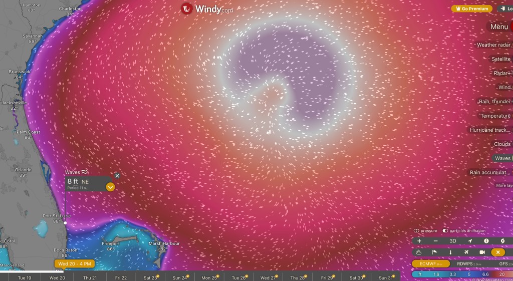
Windy. As of this afternoon. is predicting really big surf in the 6′- 9′ range north of Palm Beach. Only big wave spots like Pump House, Reef Road, Monster Hole, RC’s will be able to handle a swell that size.
Most of Erin’s effects in Florida will be from Palm Beach County north. But, from the Windy wave forecast, it’s possible to get 5′ – 6′ in mid to southern Palm Beach County.
The wave window is Tuesday PM until Thursday PM.
Check on the current surf conditions with our FREE ‘Live’ Florida East Coast Beach Webcams here on BrownieBytes.net

